When the GPS Lies: What GNSS Jamming and Spoofing Mean for Us This Summer
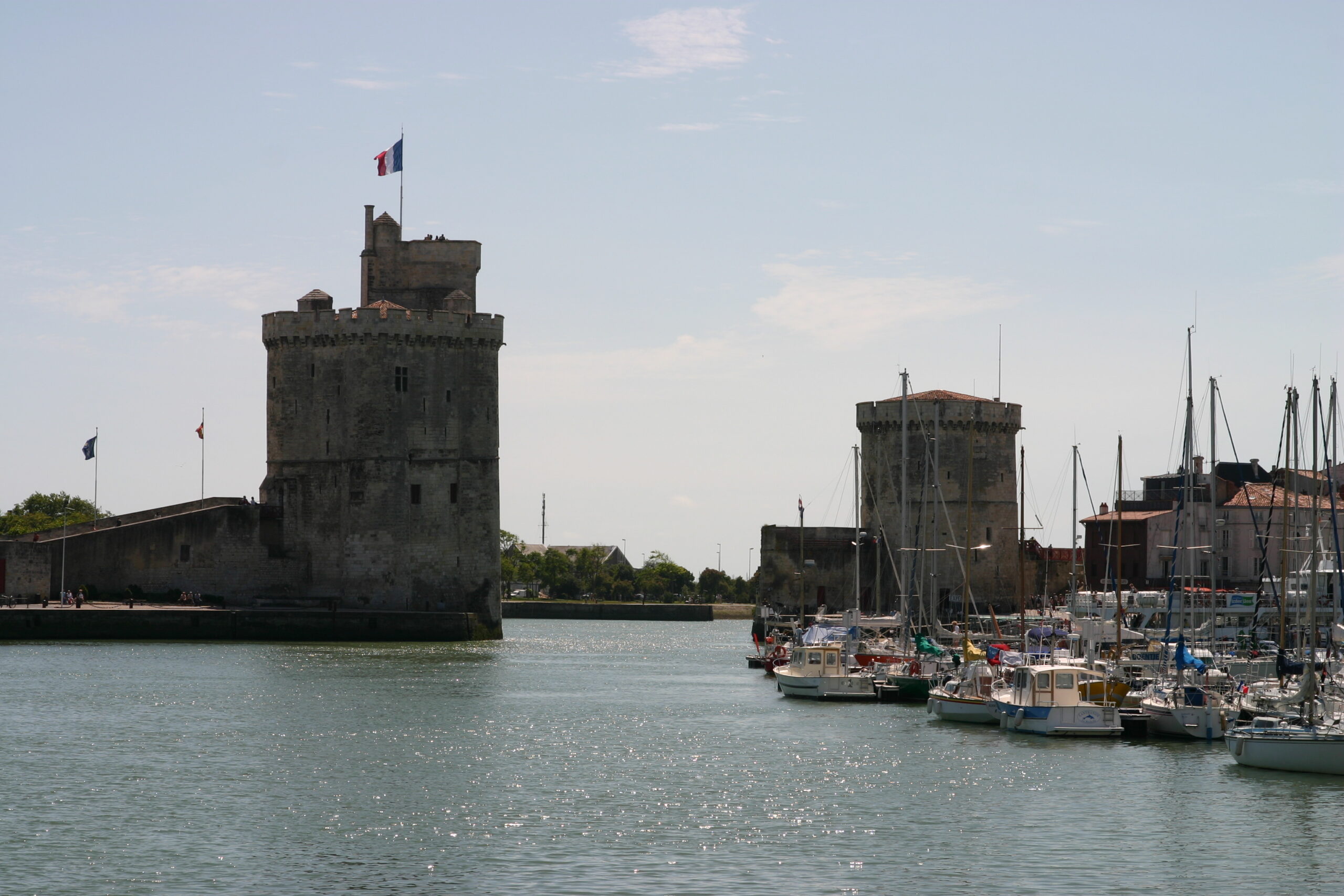
We’re a few hours into a quiet Channel crossing. Clear day, autopilot steering to the chartplotter, kettle on. Then the position on the plotter twitches, jumps a mile to the east, and settles again. Or worse, it doesn’t twitch at all, it just slowly shows us somewhere we’re not, and we’ve no reason to doubt it.
This is GNSS jamming and spoofing. For now it’s mostly a problem far from us, but it’s creeping closer, and it’s well worth getting our heads round before we meet it. Let’s go through what it is, why it’s happening, and the handful of habits that keep us safe when it does.
First, two terms worth knowing
GNSS stands for Global Navigation Satellite Systems. It’s the family of satellite networks our kit uses to work out where we are, and GPS is the American one most people name out of habit. Our chartplotter, our phone, our handheld, and the position other boats broadcast on AIS all lean on it. AIS, the Automatic Identification System, is the kit that shows nearby vessels as little targets with their name, course, and speed, and it gets its own position from GNSS too.
There are two ways that signals gets attacked.
Jamming is the brute-force one. A device pumps out radio noise on the satellite frequencies and drowns out the real signal, which is very weak by the time it’s reached us from space. The receiver can’t hear the satellites, so the position freezes, drops out, or starts wandering. The reason it’s spreading is that the gear to do it has got cheap, small, and easy to get hold of, and some of it now rides on drones, so the range is far wider than it used to be.
Spoofing is the sneaky one, and the more dangerous for us. Instead of blocking the signal, a transmitter sends out fake satellite signals that look real. The receiver locks onto them and reports a confident, plausible position that’s simply wrong. No alarm, no flashing red, nothing. That’s what makes spoofing worse than jamming. With jamming we usually know something’s gone, but with spoofing the plotter lies to us with a straight face.
Why are we hearing about it now?
Most of the deliberate interference traces back to areas of conflict and political tension, where jamming is used to throw drones and missiles off course, and the spillover bleeds across whole regions. By the numbers, the heavy concentrations are still a good way from us, in the Gulf, the Black Sea, the eastern Mediterranean, and the Baltic.
The reason it’s creeping onto our radar is closer to home. In January 2026, fourteen Baltic and North Sea countries, the UK among them, put their names to a joint warning about growing GNSS interference in our waters. So the North Sea is now officially flagged as a concern, even if there’s no neat published count of incidents there yet. The English Channel gets talked about more as a recognised risk than a place with a string of confirmed cases, and navigation experts have warned for years that a serious jamming-related accident there is a question of when, not if.
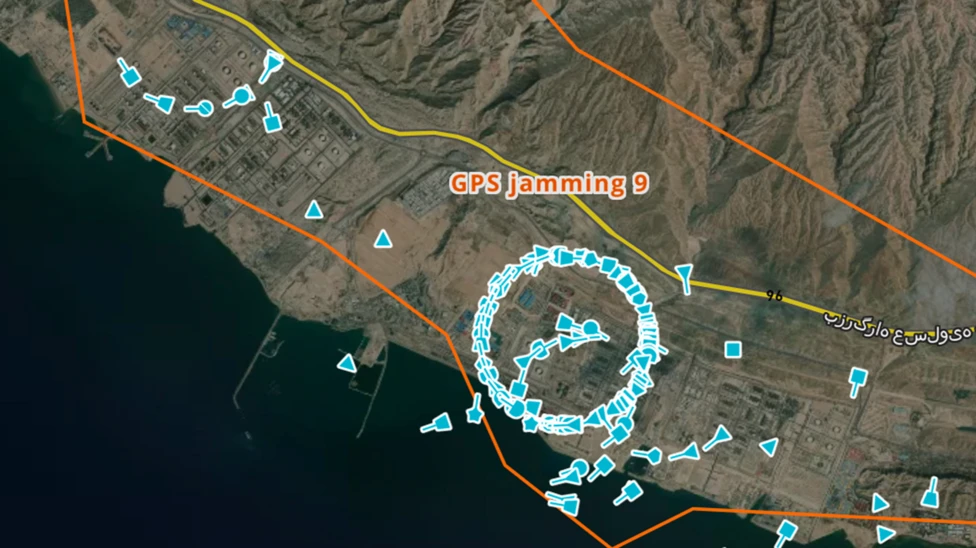
For most UK day sailing, then, dense interference is still pretty uncommon. But if our summer plans take us further afield, we’re heading toward waters where it does happen, so it’s worth building the habit before we need it. One day soon we might need to make a habit of checking a live map like GPSJam before a passage rather than assume our patch is either clear.
The fix is the navigation we already know
If we’ve worked through Day Skipper or Coastal Skipper theory, we already hold the answer to all this. It’s the good navigation practices we teach, used alongside the electronics rather than instead of them. The plotter is brilliant right up until the day it isn’t, and this is exactly the skill that carries us through that day.
The core idea is a simple one. We stop trusting one source blindly, and we keep a second, independent picture of where we are running alongside it. When the two agree, lovely. When they disagree, we’ve caught the problem early.
Spotting it before it bites
The most useful habit is to keep checking the plotter against things that don’t come from a satellite.
Radar is still electronic, but has not need for GNSS input. Comparing the range and bearing to charted objects on a radar to our position on a chartplotter is a quick and easy way to identify if one of them has an error.
Take regular fixes the old way. A transit, where two charted objects line up, is the gold standard because it needs no instrument at all and can’t be faked. A compass bearing to a charted buoy or headland is the next best. If our real fix and the plotter’s position start to drift apart, that’s our early warning.
Cross-check the depth. Compare the depth on the echo sounder against what the chart says should be under us at that state of tide. A big mismatch is a strong hint the position is wrong, because the charted depth and our real depth should roughly tally.
Watch the AIS with a sceptical eye. Other boats’ positions come from their GNSS, so in an interference area their targets can be just as wrong as ours, sometimes jumping onto land or stacking up in silly places.
What to actually do when the position goes
If we’re reasonably sure the GNSS has been jammed or spoofed, the moves are calm and ordinary.
Slow down. Speed is the enemy when we’re unsure where we are, because it shrinks the time we’ve got to think and react.
Get sea room if we can. The danger in a bad fix is hitting something, so working out into open water, away from rocks and shipping, takes the pressure off while we sort ourselves out.
Switch to DR and EP and navigate on those, plotting on a paper chart. This is the same chartwork from the course, just done for real.
Lean on the compass and the log as our primaries, not the screen. They’re not being attacked, so they’re the honest instruments in that moment.
In the worst case, where we genuinely can’t trust our position near hazards, it’s fine to stop. Heaving to or holding off in safe water until the signal comes back is good seamanship, not a failure. Many a professional crew does exactly that.
Plan for it before we slip lines
A few minutes at the planning stage makes all of this easier.
Check whether our route runs near known interference. The UKHO points mariners to live maps like GPSJam to see where jamming’s being reported, and official warnings appear in ADMIRALTY Radio Navigational Warnings. A quick look before a longer passage tells us whether to expect trouble.
Make sure we can navigate without the plotter at all. That means a paper chart or a backup chart on a separate device, a hand-bearing compass, an up-to-date almanac for the tides, and our pilotage notes for the harbours we’re aiming at. Knowing we can get in without a working GNSS receiver is a quiet confidence that makes the whole trip more relaxed.
And honestly, give it a go once in good conditions. Switch the plotter off on a calm, familiar passage and bring the boat home on compass, log, transits, and a chart. It’s good fun, it’s brilliant for our confidence, and it means the skill’s warm if we ever need it for real.
Where we’ve got to
GNSS jamming blocks the satellite signal, so the position drops or wanders and we usually notice. Spoofing feeds the receiver a fake signal, so the position comes up confidently wrong with no warning, and that’s the one to respect. Both are mostly spillover from conflict areas, still well away from us but creeping closer.
The defence is the navigation we already know. Keep an independent fix, cross-check the depth and radar, treat AIS with caution, and be ready to slow down, get sea room, and navigate on compass and log if the screen goes. Two quick questions on passage will catch almost any interference early. Does the plotter agree with what I can see? Does it agree with my other instruments?
So next time we’re a few hours into a quiet crossing and the plotter does something odd, we won’t be left guessing. We check it against the depth, our radar, and what we can see out of the window, and we’ll know whether to trust it.
Related Ardent courses and resources
The backup navigation that beats jamming is the heart of our theory courses.